
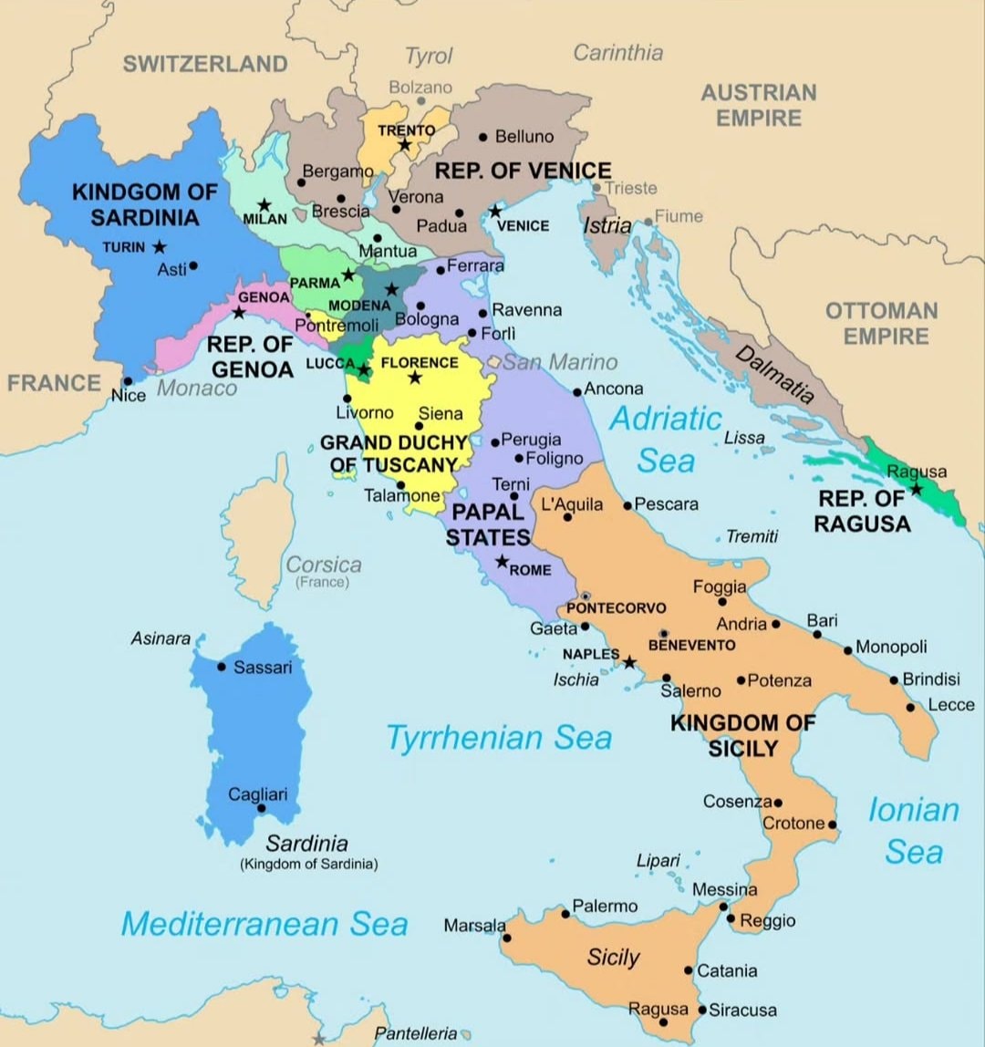
@scarlett_sItaly in 1796 🗺️ #InfoEditorials
ดูโพสต์ต้นฉบับ@scarlett_sItaly in 1796 🗺️ #InfoEditorials
ดูโพสต์ต้นฉบับรูปภาพโดย @scarlett_s· Sep 14, 2026· Info/Editorials
The image is a historical map of Italy. It shows various regions and kingdoms with their borders and names. The map is colorful and detailed, with a clear layout of geographical features and political divisions. The style is educational and informative, presenting a snapshot of Italy's political landscape at a specific historical period. Notable elements include the distinct colors used for each territory and the clear labeling of cities and bodies of water. ON-SCREEN TEXT: KINDGOM OF SARDINIA, FRANCE, SWITZERLAND, TYROL, CARINTHIA, AUSTRIAN EMPIRE, OTTOMAN EMPIRE, REP. OF VENICE, REP. OF GENOA, GRAND DUCHY OF TUSCANY, PAPAL STATES, KINGDOM OF SICILY, REP. OF RAGUSA, Corsica (France), Sardinia (Kingdom of Sardinia), Mediterranean Sea, Tyrrhenian Sea, Adriatic Sea, Ionian Sea.
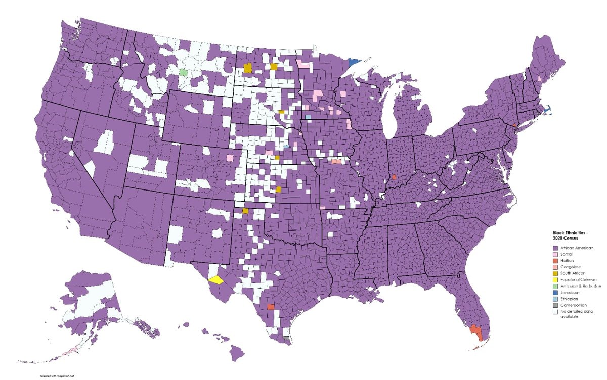 Black ethnicity by US county
 2His & Hers Netflix ranking 2026
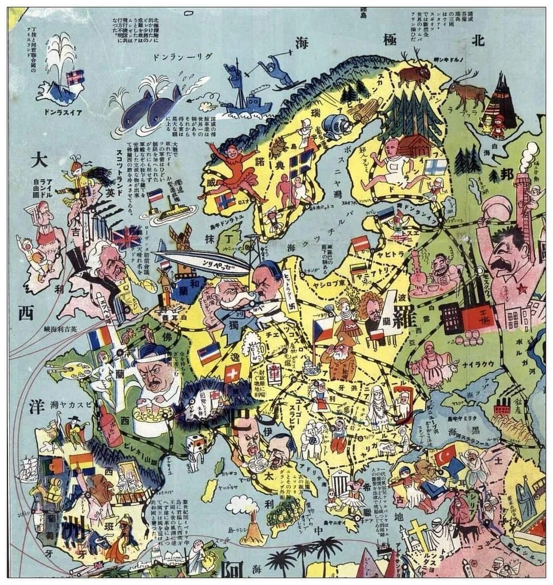 1932 Japanese map of Europe
 white ethnic groups by U.S. county
 India 1525 historical map
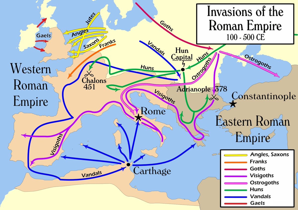 Invasions of the Roman Empire 100–500 CE
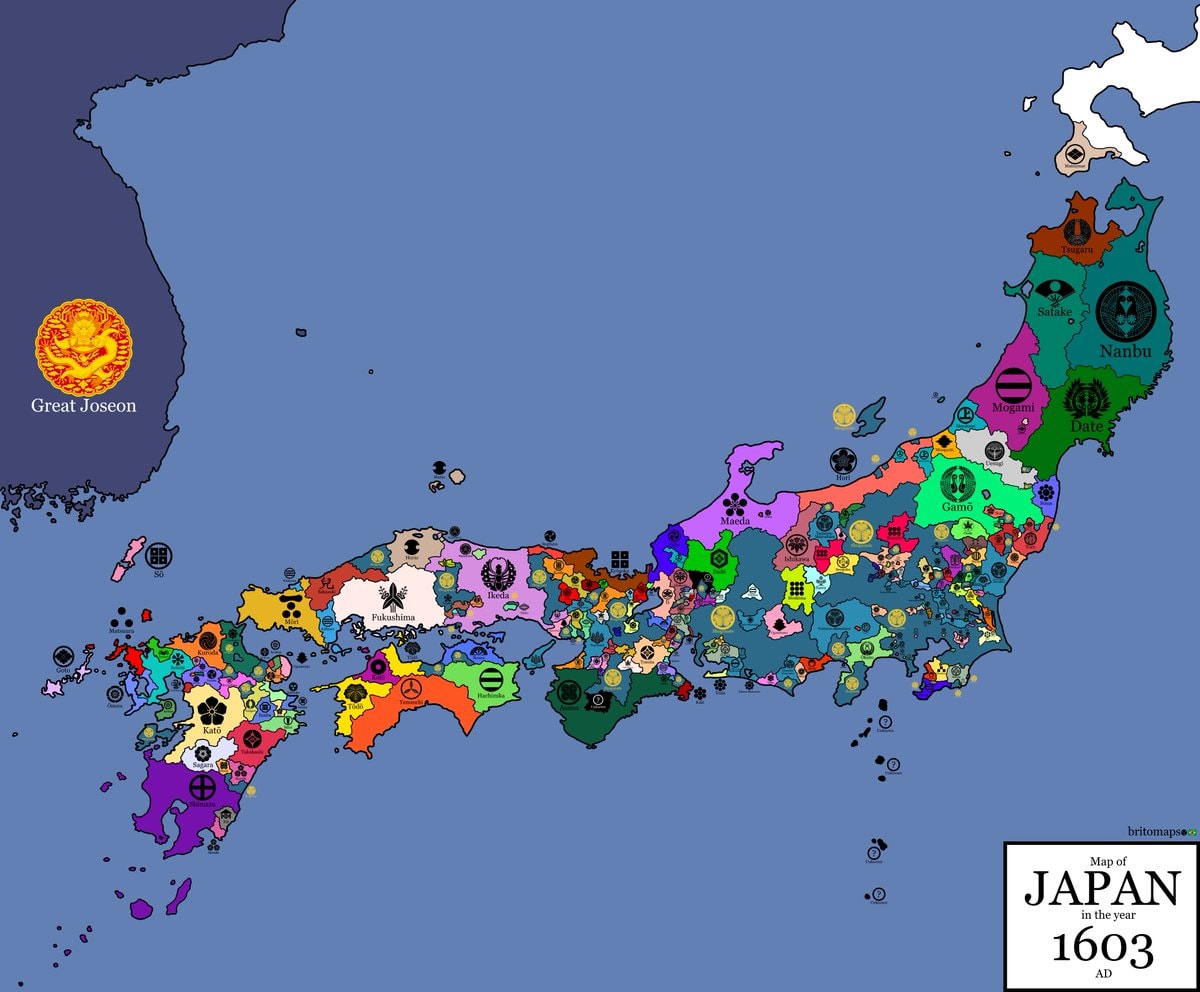 Japan 1603 map
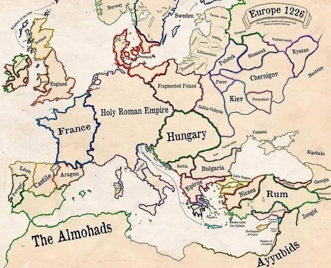 Europe in 1226
 most common US road suffixes by county
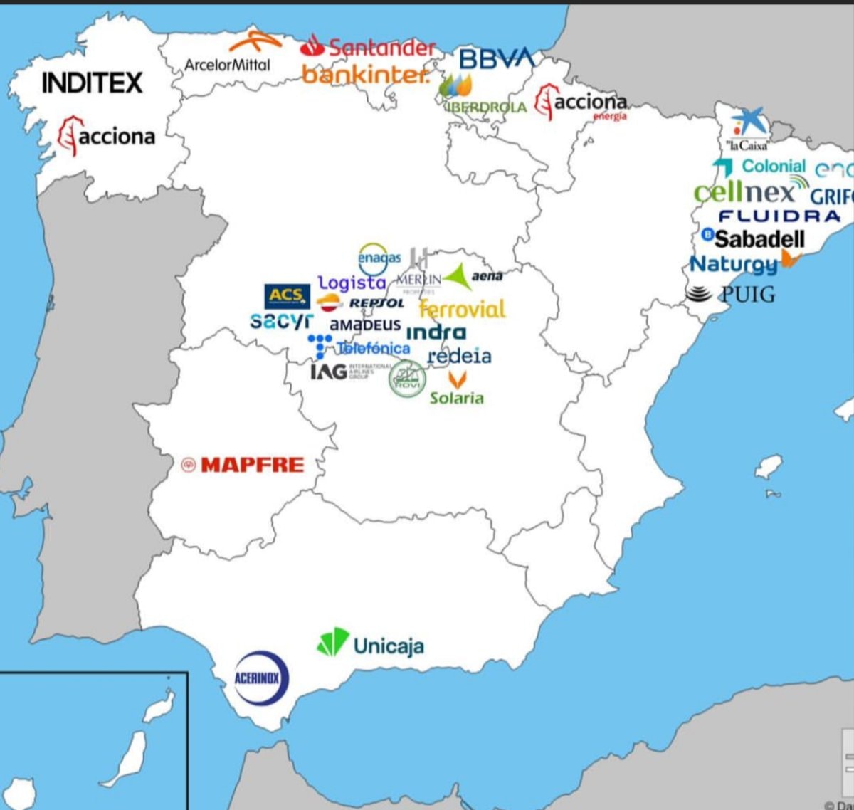 Major companies based in Spain
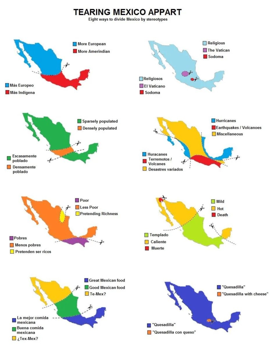 8 ways to divide Mexico by stereotype
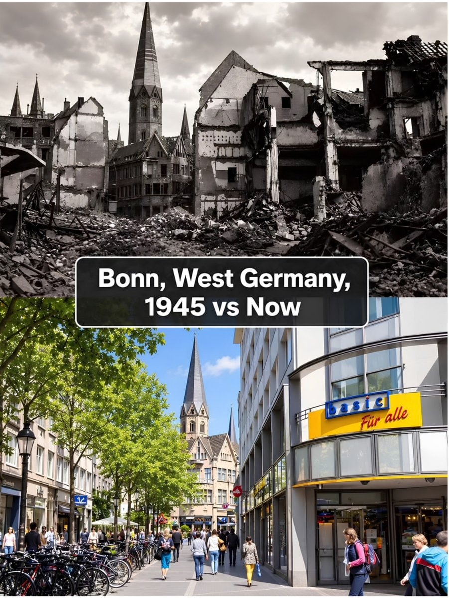 Bonn 1945 vs present day comparison
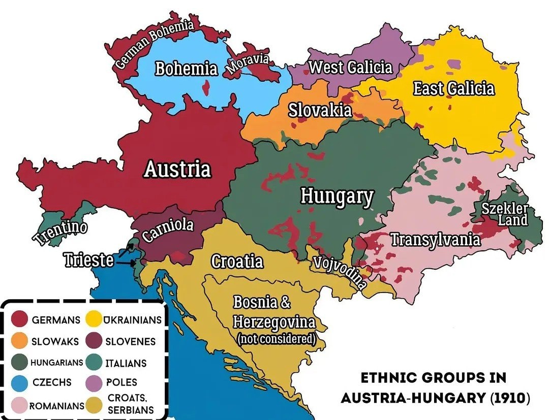 Austria-Hungary ethnic map 1910
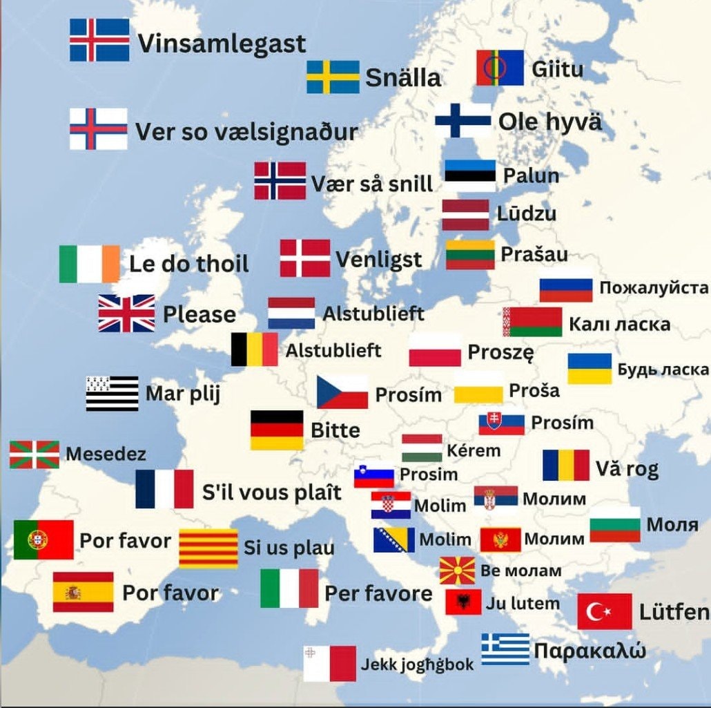 How to say Please in Europe
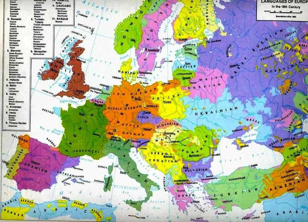 Languages of Europe map after 1882
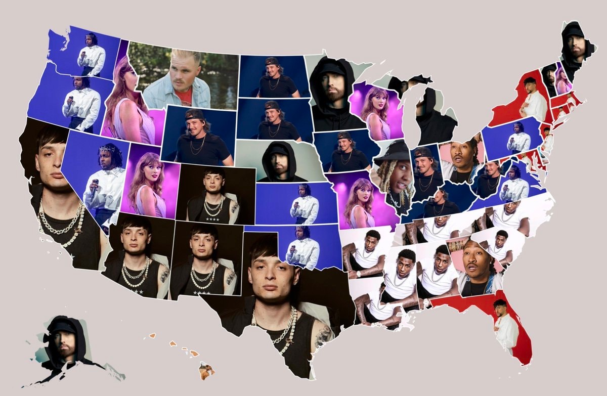 Most streamed artists by U.S. state
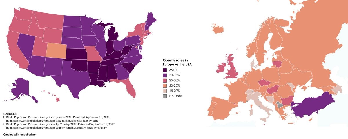 Europe vs USA obesity rates
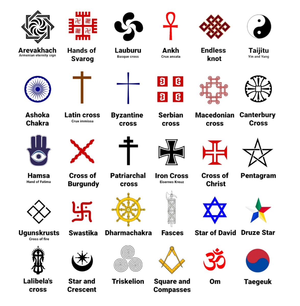 global cultural symbols grid
@scarlett_sItaly in 1796 🗺️ #InfoEditorials
ดูโพสต์ต้นฉบับรูปภาพโดย @scarlett_s· Sep 14, 2026· Info/Editorials
The image is a historical map of Italy. It shows various regions and kingdoms with their borders and names. The map is colorful and detailed, with a clear layout of geographical features and political divisions. The style is educational and informative, presenting a snapshot of Italy's political landscape at a specific historical period. Notable elements include the distinct colors used for each territory and the clear labeling of cities and bodies of water. ON-SCREEN TEXT: KINDGOM OF SARDINIA, FRANCE, SWITZERLAND, TYROL, CARINTHIA, AUSTRIAN EMPIRE, OTTOMAN EMPIRE, REP. OF VENICE, REP. OF GENOA, GRAND DUCHY OF TUSCANY, PAPAL STATES, KINGDOM OF SICILY, REP. OF RAGUSA, Corsica (France), Sardinia (Kingdom of Sardinia), Mediterranean Sea, Tyrrhenian Sea, Adriatic Sea, Ionian Sea.
ยังไม่มีความคิดเห็น มาเป็นคนแรกกันเถอะ!
Black ethnicity by US county2His & Hers Netflix ranking 20261932 Japanese map of Europewhite ethnic groups by U.S. countyIndia 1525 historical mapInvasions of the Roman Empire 100–500 CEJapan 1603 mapEurope in 1226most common US road suffixes by countyMajor companies based in Spain8 ways to divide Mexico by stereotypeBonn 1945 vs present day comparisonAustria-Hungary ethnic map 1910How to say Please in EuropeLanguages of Europe map after 1882Most streamed artists by U.S. stateEurope vs USA obesity ratesglobal cultural symbols grid
ยังไม่มีความคิดเห็น มาเป็นคนแรกกันเถอะ!