เกี่ยวกับรูปนี้
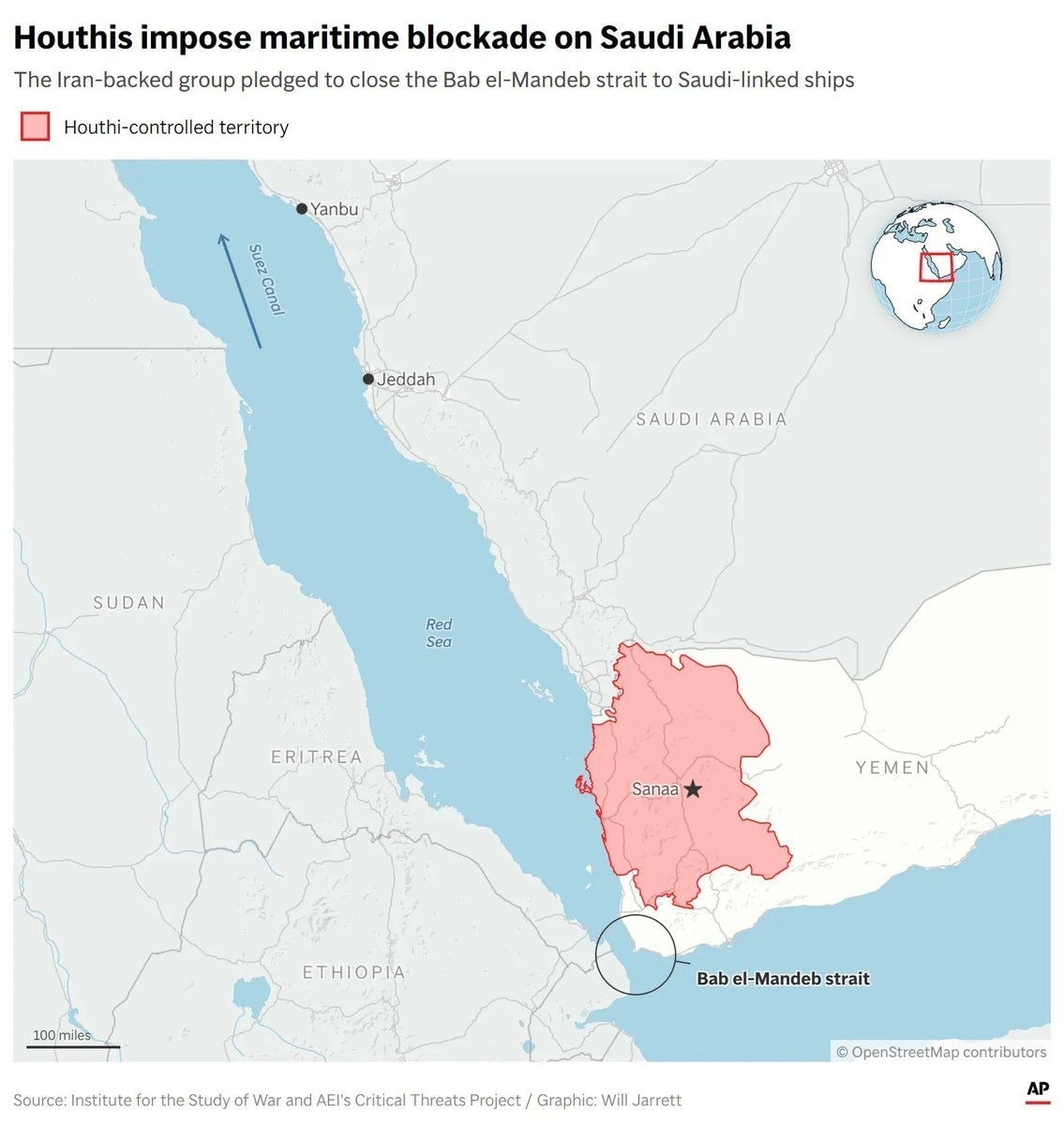
This is a map graphic focused on the Red Sea region. It shows the Bab el-Mandeb strait, the Suez Canal, and surrounding countries like Saudi Arabia, Yemen, Sudan, and Ethiopia. A highlighted area in red indicates Houthi-controlled territory in Yemen, with Sanaa marked. The overall mood is informative and news-like. Visually notable is the red highlighted area and the small globe inset in the upper right corner. ON-SCREEN TEXT: Houthi impose maritime blockade on Saudi Arabia The Iran-backed group pledged to close the Bab el-Mandeb strait to Saudi-linked ships Houthi-controlled territory AP Source: Institute for the Study of War and AEI's Critical Threats Project / Graphic: Will Jarrett © OpenStreetMap contributors